Thanksgiving elicits an image of bounty, a table filled with a cornucopia of color and foods and around which family and friends come together. The gathering and sharing of a meal is an important moment and a traditional life's pleasure for all time. It is an opportunity for reflection and celebration of that which brings true meaning to our lives.
We are grateful to have the food that has been prepared but more importantly for our bounty of blessings: the warmth within our homes, good health, the love of a husband or wife, our children - their spouses - our grandchildren, families and friends, kindness of strangers, peace and joy which surround us. . . for those things we celebrate.
Last night I received a wonderful gift when a son called from a thousand miles away and filled my heart with joy. . . overwhelming are the words of my two and a half-year old grandson saying, "I love you gwamaw". Our soul's nourishment comes from goodness and love we share.
Today we will hear the voices of sons and daughters, brothers and sisters, aunts and cousins. . . and rejoice as we hold them in our hearts.
Take time to reflect upon that for which you are grateful. May you and your family be blessed with an abundance of joy, and feast in the health and love of those not just at your table but in your hearts. Thank God for our blessings and our forefathers for the freedom that we enjoy in this great country.
Thursday, November 27, 2008
Monday, November 17, 2008
Difference a Day Makes
Early yesterday morning the birds were frantically flying from tree to tree, gathering berries amidst the cold morning breeze. Today finds an unseasonable afternoon of 67 in the shade, a time for outdoor activity.
I swept a section of the driveway, mounding the maple leaves that will go into our mulch pile, attacked a hillside of weeds that have emerged and flourish despite colder days and nights, and along the way rustled a few wild turkeys. Actually, I'm not sure who was more startled, them or me, but we each went in a separate direction.

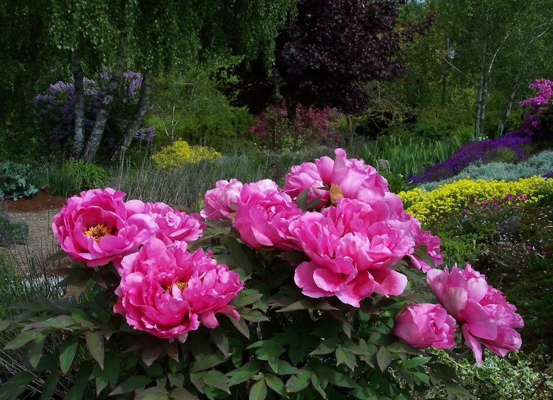
The clusters of Rosa 'Mozart' will not yield to the cold, and the little visitor decides to have a go at a bit more food at the blossom.
The Ginkgo biloba is about to give his glorious final performance, as nearly all the leaves will soon fall to the ground in unison.

Such a difference a day makes.
I swept a section of the driveway, mounding the maple leaves that will go into our mulch pile, attacked a hillside of weeds that have emerged and flourish despite colder days and nights, and along the way rustled a few wild turkeys. Actually, I'm not sure who was more startled, them or me, but we each went in a separate direction.

The clusters of Rosa 'Mozart' will not yield to the cold, and the little visitor decides to have a go at a bit more food at the blossom.
The Ginkgo biloba is about to give his glorious final performance, as nearly all the leaves will soon fall to the ground in unison.

Such a difference a day makes.
Tuesday, November 11, 2008
Veterans Day
Veterans Day is a day of remembering and a time to honor and celebrate those who have given of their lives so willingly in order to keep us safe and free as a nation and to those who continue to do so.
Thank you seems inadequate for what our husbands, wives, sons and daughters do, but to all our veterans who have served so nobly for this country, to my relatives, uncles, cousins, to our friends whose children currently serve, thank you and may God bless you and keep you safe.

Thank you seems inadequate for what our husbands, wives, sons and daughters do, but to all our veterans who have served so nobly for this country, to my relatives, uncles, cousins, to our friends whose children currently serve, thank you and may God bless you and keep you safe.

Sunday, November 9, 2008
Hall of Mosses, Washington Part IV
30 OCT continued: Yellow leaves blanketed the edge of the narrow road as moss-covered trees leaned ominously into the highway, arching, defining our entrance. As we officially entered the rain forest, the moisture tapped upon the window anointing our arrival, and the light before us darkened. Ahead were two cars in the parking lot, one couple about to leave, while the other had just arrived and entered the visitor's center. Following our lunch, we followed to find no staff, rather a tall narrow metal box, secured, in which we placed an envelope with $15 and detached a receipt to place upon our car dashboard. (The forest was very dark; click on the photos to enlarge for enhancement.)
 The Olympic National Park is approximately 1441 square miles or 922,000 acres (373,120 hectares) and within it are three ecosystems: Pacific shore, a sub-alpine forest and wildflower meadow, and the temperate forest. Today we would participate in the latter.
A sign posted elevation at 573 feet, and another telegraphed we were not to befriend (my word) any of the elk. Okay! I'm ready. We would venture through the .8 mile Hall of Mosses Trail.
Summers find the Hoh Rain forest relatively dry, but winter storms from the Pacific Ocean yield annual rainfall of 12-16 feet, which give rise to the big leaf maples, Western Hemlock, Sitka spruce, and old Western red Cedar. Some trees tower as high as 300 feet and 25 feet in diameter.

A light rain ushered us into the largest old growth forest in the Pacific Northwest with its rugged peaks, ancient trees, multi-layered canopies, and nature's felled trunks (blowdowns, they call them).

A mist-shrouded forest of epiphytic moss and licorice ferns drape the trunks of trees.
A hemlock seedling sprouts on a nurse log, and with time will sends its roots down.
 . . . whereas, where nurse log once stood and has now rotted away, enormous roots (stilts) stand elevated, a cavity between it and the earth's carpet. Self sufficient is the living, breathing, and nurturing of this forest.

My husband stands 200 feet away at the end of the downed Sitka.
How beautiful is this hard shelf fungus that appears to be fluid? Does it not look like an ice cream cone turned upside down?

 Seen in this crystal clear creek is plant life hanging to a log.
In mystical moments, we were captured, stood in solitude, and listened to the quiet.
It took slightly over an hour to cover .8 mile, and more time could have been enjoyed, but we had a long drive ahead. Another time, another visit will be necessary.
As we left the forest and began our drive back, the road was dry. Then suddenly my husband's cell phone rang! It made us laugh out loud: there are times we are disconnected while standing in our home, and here we are. . .
The dense green turned to groves of birch and the impending darkness still offered light. In just a few hours we would be back at our lodging and enjoying a marinated flank and some fresh zucchini on the grill and a nice glass of wine.

31 OCT: Day 6 and foiled was our plan to head back toward Port Angeles the following morning to visit Hurricane Ridge. As the rain and fog encroached, our morning yielded reading, laundry, and lunch at a recommended local restaurant, but never again. Two salad, two waters, tax, and tip - an outrageous $36 dollars.
A casual drive was in order for Day 6: south on 101 and a stop to view an antique light museum; 104 to Port Ludlow and north on Oak Bay Road; to Port Hadlock and back to Port Townsend and a driving tour of some of the old Victorian homes; stop at a local fish market to fetch dinner for the grill. $15 for tonight's dinner - a fine deal after that lunch.
(Just a note that gasoline prices were all over the place, from $2.45 to over $3 dollars a gallon and in just few miles of one another.)
1 NOV: Inclement weather had moved into the entire Pacific northwest, so last night we decided to pack it up and head out a day early. Our exploration had been full, and if we are to read, the comfort of our home beckons. So much left to explore, but that will have to wait for another time as our journey to this beautiful state is complete for now.
Thanks for joining us, and hope you enjoyed the time.
 The Olympic National Park is approximately 1441 square miles or 922,000 acres (373,120 hectares) and within it are three ecosystems: Pacific shore, a sub-alpine forest and wildflower meadow, and the temperate forest. Today we would participate in the latter.
A sign posted elevation at 573 feet, and another telegraphed we were not to befriend (my word) any of the elk. Okay! I'm ready. We would venture through the .8 mile Hall of Mosses Trail.
Summers find the Hoh Rain forest relatively dry, but winter storms from the Pacific Ocean yield annual rainfall of 12-16 feet, which give rise to the big leaf maples, Western Hemlock, Sitka spruce, and old Western red Cedar. Some trees tower as high as 300 feet and 25 feet in diameter.

A light rain ushered us into the largest old growth forest in the Pacific Northwest with its rugged peaks, ancient trees, multi-layered canopies, and nature's felled trunks (blowdowns, they call them).

A mist-shrouded forest of epiphytic moss and licorice ferns drape the trunks of trees.
A hemlock seedling sprouts on a nurse log, and with time will sends its roots down.

 . . . whereas, where nurse log once stood and has now rotted away, enormous roots (stilts) stand elevated, a cavity between it and the earth's carpet. Self sufficient is the living, breathing, and nurturing of this forest.
My husband stands 200 feet away at the end of the downed Sitka.
How beautiful is this hard shelf fungus that appears to be fluid? Does it not look like an ice cream cone turned upside down?

 Seen in this crystal clear creek is plant life hanging to a log.
In mystical moments, we were captured, stood in solitude, and listened to the quiet.
It took slightly over an hour to cover .8 mile, and more time could have been enjoyed, but we had a long drive ahead. Another time, another visit will be necessary.
As we left the forest and began our drive back, the road was dry. Then suddenly my husband's cell phone rang! It made us laugh out loud: there are times we are disconnected while standing in our home, and here we are. . .
The dense green turned to groves of birch and the impending darkness still offered light. In just a few hours we would be back at our lodging and enjoying a marinated flank and some fresh zucchini on the grill and a nice glass of wine.

31 OCT: Day 6 and foiled was our plan to head back toward Port Angeles the following morning to visit Hurricane Ridge. As the rain and fog encroached, our morning yielded reading, laundry, and lunch at a recommended local restaurant, but never again. Two salad, two waters, tax, and tip - an outrageous $36 dollars.
A casual drive was in order for Day 6: south on 101 and a stop to view an antique light museum; 104 to Port Ludlow and north on Oak Bay Road; to Port Hadlock and back to Port Townsend and a driving tour of some of the old Victorian homes; stop at a local fish market to fetch dinner for the grill. $15 for tonight's dinner - a fine deal after that lunch.
(Just a note that gasoline prices were all over the place, from $2.45 to over $3 dollars a gallon and in just few miles of one another.)
1 NOV: Inclement weather had moved into the entire Pacific northwest, so last night we decided to pack it up and head out a day early. Our exploration had been full, and if we are to read, the comfort of our home beckons. So much left to explore, but that will have to wait for another time as our journey to this beautiful state is complete for now.
Thanks for joining us, and hope you enjoyed the time.
Saturday, November 8, 2008
Washington, Part III
 29 OCT continued: We wanted to explore as much as possible prior to boarding the ferry scheduled for 6 p.m. From the seaside village of Coupeville we headed south to Fort Casey State Park and Admiralty Head Lighthouse. Originally built in 1861, the lighthouse was reconstructed in 1903.
 Built in the late 1890's and situated above and guarding the entrance of the Puget Sound on this now 467 acres, Fort Casey with its huge bunkers and disappearing guns never saw a shot fired during the wars. In fact, a few years following completion, the airplane was invented and this technology became obsolete.
We relished the fresh and chilling air, and as we viewed the gun emplacements and the fortification, the vast sweeping views gave us pause to linger and wonder about those who had been here.


In the distance, north of the lighthouse, we could see a large flat area and decided we had time to explore. A quick jaunt up Eagle Road to Hill Road and toward the prairie overlook at Ebey's Landing National Historic Reserve, and rather than climb the hillside, we decided to walk along the driftwood and stone-covered beach, head down, looking for agates, and filling our pockets with select stones, our new found treasures to take home.
It was time to head for the ferry and get our place in line. Look, a cafe across the road and that couple walking has ice cream. When was the last time we had ice cream? We sat and watched the brown bobbing head of a lone sea otter staring back at us, and once we were on board and en route, he disappeared and a large school of porpoise emerged.
A report of rain moving into the Pacific northwest on Friday made our decision to travel west to the Olympic National Park and Hoh Rain Forest the following morning.
30 OCT: We departed Discovery Bay at 8:30 a.m. and wound our way along 101. We thought this should be fine with a high cloud cover and 48 degrees, but within several miles and upon cresting the next hill, a light fog descended softly upon us - with one stroke the landscape had been transformed.
We passed through Sequim, called the lavender capitol of North America, and bypassed Port Angeles. The forest was ablaze in color as we saw our first sign announcing Olympic National Park. As we descended, the mountains rose around us from the vast body of water. . . Crescent Lake.
 Were the few droplets of rain a forecast of what lay ahead? The steely blue of the water cradled the reflection of golden foliage at its boundaries. Gentle layers of elongated clouds hung suspended, lingering. We rode along the water's edge in silence, respectful and in deference to her beauty.
My apology, for the photos do not represent the experience, the absolute: the powerful vastness and the hush which captured all within its reach.

We left the lake and the forest behind and traveled a flat plateau at a constant 55 degrees. 26 miles to Fork, a small town on the west side of the Olympic peninsula and the last place to find food prior to entering the park, but we had packed our lunch this morning so no stop was necessary. Once we reached there, it would take another half hour to arrive at the visitor's center. Heavily gray and more ominous cloud formations lay ahead. It was 11:20 as we made a left turn toward the Hoh Rain Forest.
Tomorrow I will post the fourth and final part of our Washington trip. See you then.
Wednesday, November 5, 2008
Washington, Part II
We quickly found our way north and headed in the direction of Aberdeen. The tide was out, thus exposing the murky mud flats and marshes - sloughs - over which we passed, one after another. A leisurely drive upon the ever winding and undulating roadway brought our focus upon the borders of dense greenery of coastal Cedar, Sitka spruce and Western Hemlock of the Willapa National Wildlife Refuge, the second largest estuary of the Pacific Coast.
As we began to gradually ascend, the scenery changed to include groves of birch, revealing a glow among the evergreens and densely forested area. Farmland and the small town of South Bend, oyster capitol of the world, were interim sites in this landscape and accompanied by the sun's strobe of intermittent and penetrating light. Route 101 to 107, 12 became 8, to 108 and then back to 101.
Like gold, the shimmering yellow leaves glistened and dangled and lingered upon the maple branches of aged trees. A road sign marked Potlatch State Park and the Hood Canal 'Watershed', Hood Canal being a 60-mile long fjord-like inlet off the Puget Sound.
It was a perfect spot for lunch as we looked upon the gentle rippling of the calm water.

 A walk along the lapping edge to look for agates, and a sea gull attempted to befriend; he scurried along side, glancing, patiently waiting . . . and when I said sorry, I cannot, he squawked with discontent, then flew away.
For miles we hugged the edge of Hood Dabob Bay as we bobbed in and out of small communities. The brightness of the day was intensified by the glow of the fall foliage. Such a leisurely drive and calmness everywhere, to think that just due east was the bustle and congestion of Seattle. Okay, enough of that thought.
We arrived at our destination, Discovery Bay, west and across the bay from Port Townsend. So good to be here and enjoy this evening and the wonderful view from our balcony.
29 OCT: 48 degrees this morning and we venture into Port Townsend for a stop at the Visitor's Center and a informative conversation with Bill. Following breakfast at a local restaurant, we boarded the ferry (reservations required) to Whidbey Island - longest island in the continental U.S. - and in thirty minutes we were there. Bill had mentioned that upon exiting the ferry, to disregard the signs to follow Route 20 E, but instead immediately turn left onto Engle Road, a more direct approach. Good advice. The drive led us through beautiful and rolling farmland and quite a nice and flourishing community, Oak Harbor, which services the U.S. Naval Air Station.
About a half hour drive would find us at the northern most point and our destination, Deception Pass bridge. It was so named because the Spaniards had charted this as a bay, whereas in 1792, Captain Vancouver's navigator and master of the HMS Discovery, Joseph Whidbey, found it to be a deep and turbulent channel connecting the Strait of Juan de Fuca with Saratoga Passage. There are two spans: 976 foot across Deception Pass and Canoe Pass Arch, a 511 foot structure.
We parked on the south side of the bridge and began our trek across the very narrow three-foot walkway. As the two-lane bridge began to shiver and shudder with the flow of tractor-trailers, trucks and automobiles whizzing past, we opted for a walk under the bridge,


. . . an amazing structure and achievement, completed in 1935 (began August 1934) by the young people of the CCC (Civilian Conservation Corp) which was established as part of President Franklin D. Roosevelt's New Deal. The cost was $482,000.
To the west of the bridge is an extremely steep trail that leads to the beach. Note the person's size in the top left water's edge.

Pan back toward the bridge and the expansive panoramic view:


Strikingly beautiful is the graceful curvature of the arching span of steel amidst the rugged cliffs and craggy edges rising from the turbulent waters below. We were awestruck as to dimension, space and time.
A drive across to Fidalgo Island for an alternate view and a return trip on 20W would find us stopping briefly for a look at the 100 year old Captain Whidbey Inn,

. . . then onto the now sleepy little town of Coupeville (bustling in the summer) for lunch overlooking Penn Cove. Crab bisque for me, clam chowder for my husband, and all we can say is it was the real stuff, the best ever.

West of Coupeville is Fort Casey, and we are headed there next. . . part 3.
As we began to gradually ascend, the scenery changed to include groves of birch, revealing a glow among the evergreens and densely forested area. Farmland and the small town of South Bend, oyster capitol of the world, were interim sites in this landscape and accompanied by the sun's strobe of intermittent and penetrating light. Route 101 to 107, 12 became 8, to 108 and then back to 101.
Like gold, the shimmering yellow leaves glistened and dangled and lingered upon the maple branches of aged trees. A road sign marked Potlatch State Park and the Hood Canal 'Watershed', Hood Canal being a 60-mile long fjord-like inlet off the Puget Sound.

It was a perfect spot for lunch as we looked upon the gentle rippling of the calm water.

 A walk along the lapping edge to look for agates, and a sea gull attempted to befriend; he scurried along side, glancing, patiently waiting . . . and when I said sorry, I cannot, he squawked with discontent, then flew away.
For miles we hugged the edge of Hood Dabob Bay as we bobbed in and out of small communities. The brightness of the day was intensified by the glow of the fall foliage. Such a leisurely drive and calmness everywhere, to think that just due east was the bustle and congestion of Seattle. Okay, enough of that thought.
We arrived at our destination, Discovery Bay, west and across the bay from Port Townsend.
 So good to be here and enjoy this evening and the wonderful view from our balcony.
29 OCT: 48 degrees this morning and we venture into Port Townsend for a stop at the Visitor's Center and a informative conversation with Bill. Following breakfast at a local restaurant, we boarded the ferry (reservations required) to Whidbey Island - longest island in the continental U.S. - and in thirty minutes we were there. Bill had mentioned that upon exiting the ferry, to disregard the signs to follow Route 20 E, but instead immediately turn left onto Engle Road, a more direct approach. Good advice. The drive led us through beautiful and rolling farmland and quite a nice and flourishing community, Oak Harbor, which services the U.S. Naval Air Station.
About a half hour drive would find us at the northern most point and our destination, Deception Pass bridge. It was so named because the Spaniards had charted this as a bay, whereas in 1792, Captain Vancouver's navigator and master of the HMS Discovery, Joseph Whidbey, found it to be a deep and turbulent channel connecting the Strait of Juan de Fuca with Saratoga Passage. There are two spans: 976 foot across Deception Pass and Canoe Pass Arch, a 511 foot structure.
We parked on the south side of the bridge and began our trek across the very narrow three-foot walkway. As the two-lane bridge began to shiver and shudder with the flow of tractor-trailers, trucks and automobiles whizzing past, we opted for a walk under the bridge,


. . . an amazing structure and achievement, completed in 1935 (began August 1934) by the young people of the CCC (Civilian Conservation Corp) which was established as part of President Franklin D. Roosevelt's New Deal. The cost was $482,000.
To the west of the bridge is an extremely steep trail that leads to the beach. Note the person's size in the top left water's edge.

Pan back toward the bridge and the expansive panoramic view:


Strikingly beautiful is the graceful curvature of the arching span of steel amidst the rugged cliffs and craggy edges rising from the turbulent waters below. We were awestruck as to dimension, space and time.

A drive across to Fidalgo Island for an alternate view and a return trip on 20W would find us stopping briefly for a look at the 100 year old Captain Whidbey Inn,

. . . then onto the now sleepy little town of Coupeville (bustling in the summer) for lunch overlooking Penn Cove. Crab bisque for me, clam chowder for my husband, and all we can say is it was the real stuff, the best ever.

West of Coupeville is Fort Casey, and we are headed there next. . . part 3.
Monday, November 3, 2008
Washington: Part I
 26 OCT - As we began our journey this morning and turned right out of the driveway, our descent was met with a glowing alignment of color. My husband said, reminds me of New England. . . well, maybe Michigan. He always makes me chuckle.
Within minutes we were confronted with fog that had settled in the valley, and as we approached I-5, the visibility had been reduced to less than a quarter mile, a reminder of the norm this time of year. Thankfully, within several miles the sun began to permeate the veiled barrier and highlight a blazing tapestry woven in shades of yellow, orange, red and umber. As we headed further north the sun and fog played a game of cat and mouse, the fog lingering mystically in the background, until finally we were shown clear sailing ahead.
Our first stop was to have lunch with several of our children and two grandchildren. Following the meal and conversation, our 9-year old granddaughter, who had a soccer game on the mind, asked what are we doing here? A signal that it must be time. A gorgeous 72 degrees, and we headed to Astoria for a relaxing evening.
 A cocktail overlooking the harbor and the bridge we would conquer in the morning and a seafood dinner at a local restaurant, was the remaining activity chosen for this first day.
Day 2: Stunning morning! A clear blue sky and a crisp 57 degrees ushered us onto the Astoria bridge and toward Washington via route 101. Off to the east and along the Oregon coastline, five large cargo vessels were anchored, either awaiting instruction or a pilot that would guide them to the Columbia River. We crossed the Washington border, turned left and snaked along the coastline through several small fishing villages and to Ilwaco. The Hwy Loop 100 marked what would be our rapid ascent to North Head Lighthouse (built in 1898).
 High above the water's edge, a gentle sloping trail (1/4 mile) led us past the original light keeper's home. . .
 and to the periphery for this century-old structure which has helped guide ships in this "graveyard of the Pacific".
 One of the most treacherous bars in the world has been created here from the force of the Columbia River flowing into and meeting the Pacific Ocean. Panoramic views and a sight to behold.
 From the front side of North Head Lighthouse, the deceiving waters appear calm beneath the sharp decline of the hillside.
 We decided to locate a lunch spot in Long Beach, our destination for the evening, and then return to do our hike to Cape Disappointment and the lighthouse (built in 1856), now a part of Fort Canby State Park. A seafood restaurant was recommended, and as we sometimes say, we were there twice, our first and last. Expensive, not very good, and exactly the reason we prefer cooking our own. However following that, a beautiful 64 degrees had us eagerly heading back.
Although these two lighthouses were built two miles apart in order to guard the ships coming from the north and south, over the years 2000 ships and 700 lives have been lost in this confluence. The waters are so treacherous that the U.S. Coast Guard uses this as training ground.

By the way, the name is appropriate from our standpoint as it did disappoint: the area was closed for the U.S. Coast Guard firing practice, so our hike was canceled. We did however enjoy it from the distance, including this great expanse to our right.
 We checked into our night's lodging at Long Beach, then decided to drive north toward Ocean Park to see the rest of this 28-mile peninsula, many miles of which were driven on the wide sandy beach, considered a Washington State highway. The afternoon fog rolled in and guided our return to an evening of relaxation, a glass of wine, and our own prepared dinner. But first this half-mile boardwalk required our attention.
 Day 3: The morning found us arising early as usual, morning coffee in hand and a walk out onto the deck to watch the sun awaken this pristine beach of sand and dune grasses.
Sandwiches were made for the cooler - tuna on wheat - and by 9 a.m. we were traveling south but only to the point of picking up route 101 again.
(The second part of our journey will follow.)
Subscribe to:
Posts (Atom)